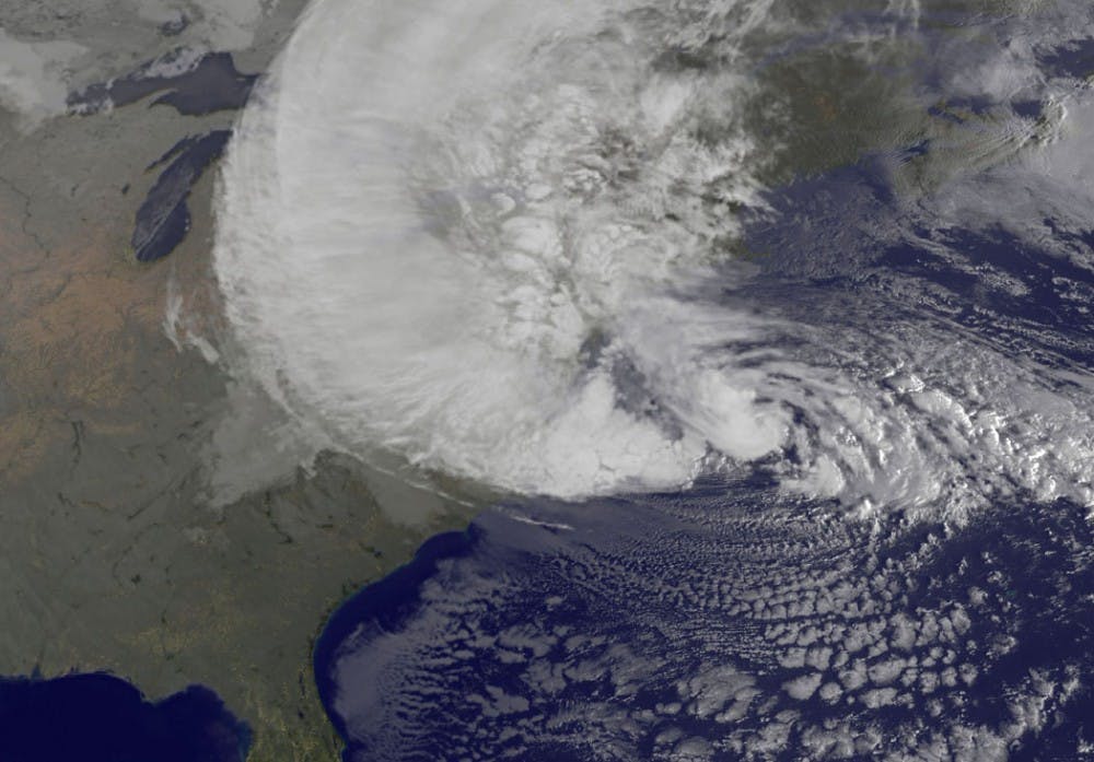
NOAA’s GOES-13 satellite captured this visible image of Hurricane Sandy battering the U.S. East Coast Monday morning. Sandy’s center was about 310 miles south-southeast of New York City. Tropical Storm force winds are about 1,000 miles in diameter. Courtesy NASA GOES Project


