The Great Lakes and their coastlines are a vital part of Michigan’s environment, as well as surrounding states.
Many factors affect coastal communities, including storms, high water levels and human disruption. Consistently monitoring and studying these coastlines can help prevent further problems.
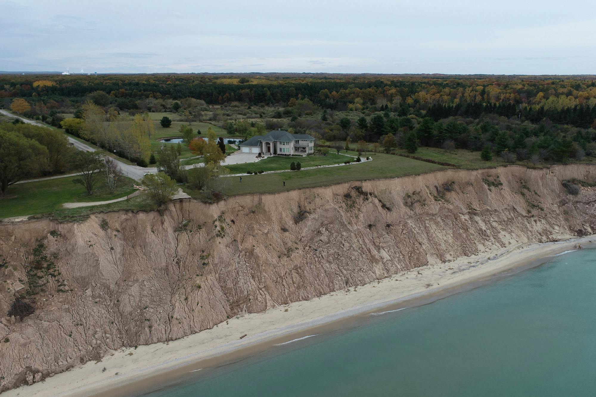
Ethan Theuerkauf, an assistant professor in the Department of Geography, Environment, and Spatial Sciences as well as a geomorphologist, said that without intervention, climate change will result in habitat loss.
“Our research indicates erosion rates jumped significantly due to how quickly the lake levels rose as opposed to just how high they rose," Theuerkauf said in a press release. "Given that climate change is likely to increase the variability in lake levels moving forward, we anticipate that we will see sustained habitat loss, especially without intervention."
Michigan State University created the coastal thematic research area to study the Great Lakes coastlines in order to understand coastal change and provide information to prevent problems this environment faces.
Theuerkauf leads the project and works with a team of two researchers on the project, Elizabeth Mack and Erin Bunting.
Bunting explained the importance of collecting the coastline data and imagery.
“Ethan and I, even before he came to MSU, we got chatting about what it means to image the coastlines of what we can do with imagery of the coastline,” Bunting said. “And it became apparent that the imagery was super valuable.”
The problem became apparent: they needed to collect imagery on a consistent basis.
The team decided to call on the help of “drone-flying citizen scientists” in multiple communities across the state of Michigan to capture imagery year-round.
The program was created about three years ago but recently applied for a five-year extension from the National Science Foundation.
"The goal to make this a long-standing program," Bunting said. "Collecting this type of imagery for one or two years, while its highly valuable, the better value is if you have a long term time series of imagery."
Currently, the program focuses on six Michigan communities to study their coastline imagery acting as a pilot program in its current stage.
The program also has a mobile upload website for citizens to upload images if they were to see a coastal hazard, which is then entered into their database.
“Honestly, the sky’s the limit on the number of citizen scientists we can have on that side of things,” Bunting said. “Collecting those ground-based images helps with our models for forecasting things into the future. And so the more the merrier.”
To take part, all you need is a smartphone and the Citizen Science Imaging website: http://bit.ly/PicShores.
Support student media!
Please consider donating to The State News and help fund the future of journalism.
Discussion
Share and discuss “MSU researchers call on citizen volunteers to help study coastlines” on social media.